
Coney Island (Pulau Serangoon) (then)
This photo (above) was taken in March 2015 before the opening on 10th Oct 2015 and it was reported that it was last opened in 1st July 2015.
Short history of Coney Island
Coney Island has several names by itself - Serangoon Island or Pulau Serangoon. In 1930s to 1950s, it was also known as Haw Par Island, is solely owned by Haw Par Brothers who bought the island.It has uninhabited for decades but it was once a popular spot for family picnics, and activities such as water-skiing, boating and fishing. Kelongs were once dotted the water off the island. In April 1950, Ghulam Mahmood, an Indian businessman took over the island and planned to turn it into resort. He renamed the island after the Coney Island amusement park in New York. However, his plan was not realised and it left abandoned. In Nov 1972, PSA purchased the island to develop for recreational purposes. In 1974, E.W Baker then Minister for National Development announced that the two link-bridges would be built to connect Coney island to the mainland. In Mar 1987, S. Dhanabalan then Minister for National Development, annouced that the northern islands would be developed the recreation with Coney island as part of the upcoming the Punggol New Town project.
Pulau Serangoon is also a popular place for jet skiing and camping in the past. However, this has led to the beaches being polluted by litter such as discarded cans, instant noodle packets and bottles which I saw earlier on 10 Oct 2015. Later I will post the photo of the littering around the island. I still remember the last time when my colleagues and I went to visit our friend who lived in Kelong Fishing hut in 1990s which was once stood in the middle of the two islands - Pulau Ubin and Coney island. It's been a long time since and I still keep a photo of the Kelong fishing posed with my friend and those memories of the Kelong Fishing huts that he once lived when he was a child back then. We used motorised sampan to reach the Coney island near the jetty port for a picnic then back to the fishing village. Those were the good old days.


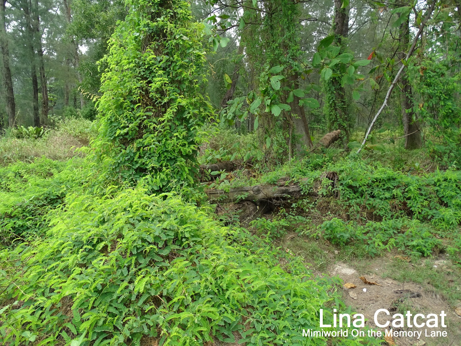
You will be able to see it if you join the guided tour. Its footpath is narrow and uneven.


Pulau Serangoon is also a popular place for jet skiing and camping in the past. However, this has led to the beaches being polluted by litter such as discarded cans, instant noodle packets and bottles which I saw earlier on 10 Oct 2015. Later I will post the photo of the littering around the island. I still remember the last time when my colleagues and I went to visit our friend who lived in Kelong Fishing hut in 1990s which was once stood in the middle of the two islands - Pulau Ubin and Coney island. It's been a long time since and I still keep a photo of the Kelong fishing posed with my friend and those memories of the Kelong Fishing huts that he once lived when he was a child back then. We used motorised sampan to reach the Coney island near the jetty port for a picnic then back to the fishing village. Those were the good old days.

Short Path to Haw Par Beach Villa
I remember there is a derelict Haw Par Beach Villa located at Coney Island, built by Haw Par Brothers in 1937 in an open tender and only known the remaining villa belonged to the Aw family. Haw Par Villa was damaged during WWII and its ground are currently managed by the STB (Singapore Tourism Board) as a tourist attraction. Another Villa, the Aw Brothers owned "Jade House" at Nassim Road, was demolished in the 1980s. Its architecture has a centred hall and an open veranda that surrounded the house. A single storey of the villa served as a service block. The area of the main building is about 600 sq. meter and the service block is about 100 sq. meter. Built in the Modern architecture style, its architect was Ho Kwong Yew, a leading local architect of the Moderm Moverment during the 1930s.
Haw Par Beach Villa

A Old Disused Well
So I went there with my hubby and there is a short path leading to the abandoned beach villa, after a few mins walk, finally we found it and it looks forlorn and dilapidated villa. Who could imagine such a big house with a garden and a well that still exists. The surrounding of the beach villa is fenced up just beside the uneven wooden footpath and we are able to peek in thru the small opening fence behind the villa. You will be able to see it if you join the guided tour. Its footpath is narrow and uneven.

Coney Island (Pulau Serangoon) (Now)
In the year 2014, it was announced that the island will open to the public in 2015. The Urban Redevelopment Authority (URA) said that under the Master Plan, a part of Coney Island is zoned for residential, sport and recreational use but as the land is not immediately required for development, a part of Coney Island will be kept as an interim park for the time being. But I hope that the island will not go through redevelopment as it will lose its rich historical past and no one especially young generation will never know what it was like back then if it transforms into resorts and entertainments.

Inside Coney Island
Thus, Coney Island Park opens to the public on 10th Oct 2015, with a beach stretching 2.4km long path that is part of the park connector network. It is home to some 80 species of birds, some otters, 86 tree species (53 fauna and 17 tree species) are considered locally threatened.

Cattle (Cow)
Heard that there is a cow roaming in Coney Island and it's a mystery on how a cow lands on the island. But I only know that a cow/bull can live through 15 years and am wondering if a cow still alive or not as it's been a long time since a cow is landed in this island. It is a Brahman, a breed of Zebu male cattle that originated from South Asia, identifiable by its large, pendulous ears and dewlaps, also known as loose skin that hangs from the neck or throat. It also has a prominent hump over its shoulders. I heard that someone who saw this cow some weeks ago and its horns seem to be growing downwards towards the eyes, thinking he must be banging its head to the tree in frustration as he feels lonely. The cow seems very well-fed.

Cow@Coney Island
I also heard from sources/theory that a long time ago, there was a boat carried 3 cows transporting onto the island and one fell off the river and made it way to the shore. Some reported that it has been there for several years, under the care by NParks, where it undergoes veterinary check-ups every six months to make sure it is healthy. Every 6 months? Six months is a long time and did they look out to check on it every once a week. And who knows what will happen to the cattle/cow? Well, I didn't see a cow(cattle) when I ventured into the forested woods on 10th Oct 2015, from West Entrance to East entrance. Who knows some foreign workers might do something if they spot him.

West Promenade area
As I walked to the West Promenade to where the beach A is located about 500m away. There is a shelter is located 100m away from West Promenade (200m).

footpath to Shelter 1
At the Shelter, certain rules have been stated and obey the rules of the island is applied to each location - no lighting is provided in this park (For your own safety, please do not enter the area during night time as the park is closed at 7pm daily), No Camping and No Smoking (Fine up to $2000) but I saw a foreign worker smoked inside the island while doing some construction work where I stood opposite Punggol Promenade Nature Walk some months back.

Close-up: Shelter 1
As you can see the benches which are inside the shelter of that is minimised the use of recycled materials found on the island, and by conserving the energy and water so as the carbon footprint of maintaining the island is reduced. The 'timber' benches, table and seats in Shelter 1 are constructed from Casuarina wood. Even Park Signage made from Casuarina wood as well as timber boardwalk too. The shelter in which visitors or nature lovers would love to sit and relax.

West Promenade Path
A short distance to where the bridge is seen in the centre shown as above from where we came in through the West entrance gate. A very refreshing cool breeze in the sea.

Wave strikes the surface of the Promenade
It is indeed the cool wind that causes the waves strike the West Promenade path.

Overlook the Punggol Settlements
From the West Promenade, you can see The Punngol Settlement near the west entrance bridge where a foreign worker sat on the sandy beach.

A slow snail is spotted
As I was walking the Promenade, spotted a slow snail on the grass hidden away from the beach. And I could see some baby snails below the West Promenade steps which many people couldn't see as it is so tiny as if people would step on it without seeing on the ground if walk pass.

Fishing Rod holder
I notice a 'Rusty' Fishing Rod holder on the shoreline on the West Promenade to where there were once many people who were out fishing back then.

West Promenade with benches
Walking further up the Promenade shoreline until reached to the Beach A will take about 500m away from where the original point (main path) at West Promenade is located about 300m. This photo (above) we reached here the distance we walked about 300m that means we had walked from the starting point in the first place.

Cycling on Promenade pathway
Some visitors or local residents happily cycling along the West Promenade pathway while others like me walking along the path. My hubby and I do prefer walking instead of cycling as I might be able to see a lots of unusual things or wild animals going around the island. It also makes our calories burned from exercise and keep fit.

Bird Hide
How many birds can you spot from this Bird Hide? Well, this picture above is the Bird-watching Hide or Bird-watching station by many, it provides partial cover so that you can observe wildlife, especially birds from a closer distance without them becoming alarmed by your presence. It is made of poles installed like blinds with branches of leaves and roots covered on it.
I reached to the beach with full of stones lying around facing the sea and eventually saw a young guy walking around for a short while and turned back to where he came from. I recognised him from the Beach B (see pic above) far right corner where he came from, It's because his bicycle was parked there and he couldn't walk further here to where we were.
I reached to the beach with full of stones lying around facing the sea and eventually saw a young guy walking around for a short while and turned back to where he came from. I recognised him from the Beach B (see pic above) far right corner where he came from, It's because his bicycle was parked there and he couldn't walk further here to where we were.


Rubbish dam
So we ventured into the forested area from the Bird Hide to the rubbish dam where the previous visitors or foreign workers had left items (empty bottles, slippers..etc) on the ground and even a beach ball (far left) is seen on the piled of stones as if there were children playing in the area. It is indeed unhealthy to the environment of the island and there are many sand files buzzing around the beaches because of the rubbish dam nearby.
Forested areas
We walked into the forested area in the hope to see unusual items lying around or birds flying around. It is less deep in the forested compound and it is tough to walk as there are many dead branches hanging around, fallen trees, dead leaves on the ground and rat holes if you step/walk into the mouse hole. Please be careful and be alert of the surroundings if you intend to venture into forested area.
Typical Rope Tube
Found typical old style rope tube alongside into the forested area that foreign workers must have left it there.

Escaped from forested to main path (hidden view)
Bashed through the forested with thick overgrown area and fallen tree trunks that blocked us to the main footpath was not an easy job if you are unable to find the way to the path leading to the next route. I managed to escape from it with the help of my hubby who was an old time army expert to the training field to the forested areas in early1970s. As least we weren't lost anyway and we managed to walk all the way despite the rough sandstone footpath.
Young guys took photo of the trees
After we left the forested area and walk along the footpath and saw these two young guys with bicycles stood there to take a photo of the trees. Just wonder whether the guys have seen a bird perched on the tree.
Down slope hilly footpath
I saw my hubby walking down the slope to where the guys were there on the up slope (see below pic).
Up slope hilly footpath
The up-slope hill footpath to where these guys came from the down slope to cycle up the hill by dismount the bikes and push their bikes up the hill instead of cycling up as it is too dangerous otherwise they would fall back to the down-slope on the rough sand stone path. Even the mountain bike couldn't help too.
Beach Area A
The footpath slope leading to the Beach Area A is about 500m to where you can see sandy "white" beach.
Park Signage@Beach A
In Beach A, at the corner end to the left, there is a Park Signage indicates "Coney Island" facing the sea. But you have walk over to the corner end and be able to see the words on the left side. Young couple were seen snap a photo at the signage.
Young couple at Park Signage

Beach with wooden nets
It is believed that wooden nets tightened up the wooden bamboo to prevent any objects or materials from piled up or rushes up the land beach by the waves or storm.

Sandy white beach
As we walked out to the beach and strolled along sandy bravely from the strong wind that blowing to our face to reduce the heat from our body as it was hot and humid day and less hazy. And luckily, we wore long pants and track-shoes to prevent the bite from sand flies that buzzling around us. Sandflies are the beasts I most dread on the shore. I don't fear them even more than mosquitos. Hahaha. But I saw a sandfly on my arm and I hit it back and it fell off, got an itch minute later, then didn't feel an itch. I believe it is the female sandfly that bites me for the blood meal that she needs to make her eggs. To prevent bite from sandfly, you need to apply cream or lotion that a fly hates most.To prevent from bite, cover all skin, wear long pants and long sleeved shirt. Do not apply repellent and it smells awful and toxic to human beings and the smell of repellent may actually attract the beasts too.

Another Rope found

Cover rack

Wood Block
Along the beach, you may find other items lying around, wastes in plastic bags, even water bottles and wood blocks too. You can see the 'large' rubbish plastic bags lying around the beach

Beach Area B
After walked about 300m from Beach area A to Beach area B and finally we reached, looked slightly different shapes of wooden benches made of Casuarina wood. These benches we would sit on and watch the sea breeze blowing and relax for a while after a long walk.
Two trees with branches & leaves
The timber of fallen Casusrina trees is used to make benches, signs and board walks and these trees would have been used for. The root of the trees is not damaged and it is added with black soil moisture surrounds it that helps the trees to survive and grows again.

Another Bird Hide
Another Bird Hide which is just 100m away from Beach area B. But it is different from the very first point of Bird Hide from Beach area A and its surroundings forested area.
No Entry to the forested
This path leading to the deep forested area is out of bounds (no entry), a short distance from the Bird Hide (100m away Beach B). Do not attempt to enter this point for your safety. It could be a cow living around that area but did not spot it so far.
Shelter 2
This shelter 2 is located 100m from Beach area B and the exit at Lorong Halus is about 1.7km from here. Notice that there is no "Table" bench at the shelter 2.
Path to Lorong Halus 1.6km
Now we have to walk along the main path to Lorong Halus which is about 1.6km from here as seen the van/truck in the middle of the path.
Path to Beach area C
After a few minutes walk, we reach another Beach area C path, is about 300m from here and 100m to Boardwalk. This guy wore like a park ranger cycling towards and he smiled at me when he saw me took a shot of him cycling. Yeah!
Park Signage leads to East Promenade
After a long walk from Beach area C (1km) till we reached the Park Signage that leads to East Promenade about 200m from here (total about 1.2km) but we want to go to the ending point at East entrance locates at Lorong Halus about 200m. To Nature walkers, please keep on the left for giving some space for cyclists. 
Park Signage
After we passed by the Beach area D and E but we slipped the route and we were going to reach the East entrance just 200m away. Maybe next time, we will go again and cover the rest of the paths that we skipped. There is a poster pasted on the park signage indicated the bus timings printed by NParks.
East Entrance@Coney Island
Finally, we reached at the East Entrance after a long walk 2.4 km from where we started off from West Entrance (400m from The Punggol Settlement). It was indeed 3 hours and took lots of photos during the walks and we felt exhausted during the journey at Coney island.
At the corner end of the island (east side)
I managed to snap at the end of the island point to where we stood here. It was indeed hot and less hazy (clear sky).
Grey Heron (Ardea Cinerea)
At last, I managed to spot a Grey Heron (Ardea Cinerea) stood on the stone bench afar in the middle of the Serangoon Reservoir Dam. No one ever notice, see or spot her while they just cycled or walked straight to the end of the Dam (Serangoon Reservoir) briskly. My hubby was the one who alerted me about the bird with his hands movement as I was just a few meters away from him. Wow! That's close.

Serangoon Reservoir Dam
So we walked another 200m from East entrance to the ending point of the Serangoon Reservoir Dam and it was indeed a long walk again. But it's worth it anyway as long as our legs could carry us.
Another No Entry path
As we walked another 20 minutes and saw another path with a signage - "No Entry".
Lorong Halus Wetlands
This entrance leads to Lorong Halus Wetlands after a few minutes walk from "No-Entry" path.
Otter
After we passed by Lorong Halus Wetlands, walked along the Pasir Ris Coast Ind Park 6 that leads us to the Lorong Halus Bridge to see the otters at the Punggol Serangoon Reservoir aka Sungei Serangoon. But before that, we washed up at the toilets which is located at the visitor centre at Lorong Halus Wetlands.
Family of smooth Otters
We stopped by just to see the otters were swimming across the Serangoon reservoir and noticed one of the otters dive into the reservoir to catch a "live" fish and feasts on it.

Otter eating a fish using its webbed hands
It is indeed a sad sight of one of the otters feasts on a poor fresh koi or fish with its webbed hands.

Otters sightings at Lorong Halus Bridge
At least, you can see all the migratory birds perched peacefully on the tall Casuarina trees, on the opposite bank in the distant that was on Coney Island.
I hope such places as Coney Island, with its wild flora and fauna, should be kept as it is – undisturbed, and in its natural state for preserving wildlife and biodiversity.
If you are intend to come to visit Coney island, here a few important to take note of it.
Distance - East and West entrances are located 2.4km apart.
Toilets - are located at the East Entrance or along the Serangoon Reservoir Dam. If you are entering from the West Entrance, the nearest toilets will be at The Punggol Settlement (500m away).
Foods and Water - Bring along water bottles and packed foods as there are no food or drinks sold on the island. Nearest 7-11 shop is located at The Punggol Settlement or bring along foods from your area in the first place after you had decided. Remember not to leave the foods behind after you finish eating as it will attract the flies and animals. Bring along your recycled plastic bag just in case if there's no bin around. Do NOT litter. Only the bin can be found just outside the entrances. Let's make Coney Island more fresh air and greenery is a refreshing change for nature walks.
The island is open from 7am to 7pm. The gate closes at 7pm, so remember to leave the island in time!Toilets - are located at the East Entrance or along the Serangoon Reservoir Dam. If you are entering from the West Entrance, the nearest toilets will be at The Punggol Settlement (500m away).
Foods and Water - Bring along water bottles and packed foods as there are no food or drinks sold on the island. Nearest 7-11 shop is located at The Punggol Settlement or bring along foods from your area in the first place after you had decided. Remember not to leave the foods behind after you finish eating as it will attract the flies and animals. Bring along your recycled plastic bag just in case if there's no bin around. Do NOT litter. Only the bin can be found just outside the entrances. Let's make Coney Island more fresh air and greenery is a refreshing change for nature walks.
If you are traveling in car or by bus
1) To get to the East Entrance, drive down the Tampines Expressway to Pasir Ris Coast Ind Drive 6, past along Lorong Halus Wetlands.
2) The West Entrance is a more accessible, park at The Punggol Settlement carpark and walk about 500m along the Punggol Promenade Nature Walk to get to the entrance. If you are travelling by bus, take bus service 84 from Punggol bus interchange (Punggol Mrt) to Punggol Point Park at the Punggol End.
2) The West Entrance is a more accessible, park at The Punggol Settlement carpark and walk about 500m along the Punggol Promenade Nature Walk to get to the entrance. If you are travelling by bus, take bus service 84 from Punggol bus interchange (Punggol Mrt) to Punggol Point Park at the Punggol End.
Beside Punggol Promenade Nature Walk
Opening Hours: 7am to 7pm daily
Getting there: From Punggol bus interchange, take bus service 84 to Punggol Point Park at Punggol End and walk about 700m along the Punggol Promenade Nature Walk, to get to Coney Island West Entrance.
Parking: The Punggol Settlement carpark, 500m to the West Entrance.
Admission: FREE
Guided Walks: Pre-registration is compulsory. Visit NParks website to register for the respective guided walk as below. Well, it seems some of the respective date slots have already taken up. A quick overwhelming response indeed! Let's hope there will be next for Guided walks soon.
21 Nov 2015: 10.00am - 11.00am
28 Nov 2015: 10.00am - 11.00am
5 Dec 2015: 10.00am - 11.00am
12 Dec 2015: 10.00am - 11.00am
19 Dec 2015: 10.00am - 11.00am
In additional, there is a shuttle bus pickup point at both destinations for guided walks and visitors I presume - To Pasir Ris and Punggol Mrt.
Bus timings - First Bus: 11.15am and Last Bus: 1.30pm (*Buses arrive in intervals of 15-20mins). For more information, refer to NParks' website.
Notes to remember: Whenever you visit the Coney island, take Nothing But only Photographs & Memories, leave Nothing But only Footprints leave behind.
Excellent sharing indeed !
ReplyDeleteGreat pictures and details.
You have done a good deed for all who love Coney Island.
Thank you, Unk Dicko! :)
Delete