Huge turnout!
It was huge massive turnout event over 70 participants and even they bring their friends along thus increase to 100? Oh wow!


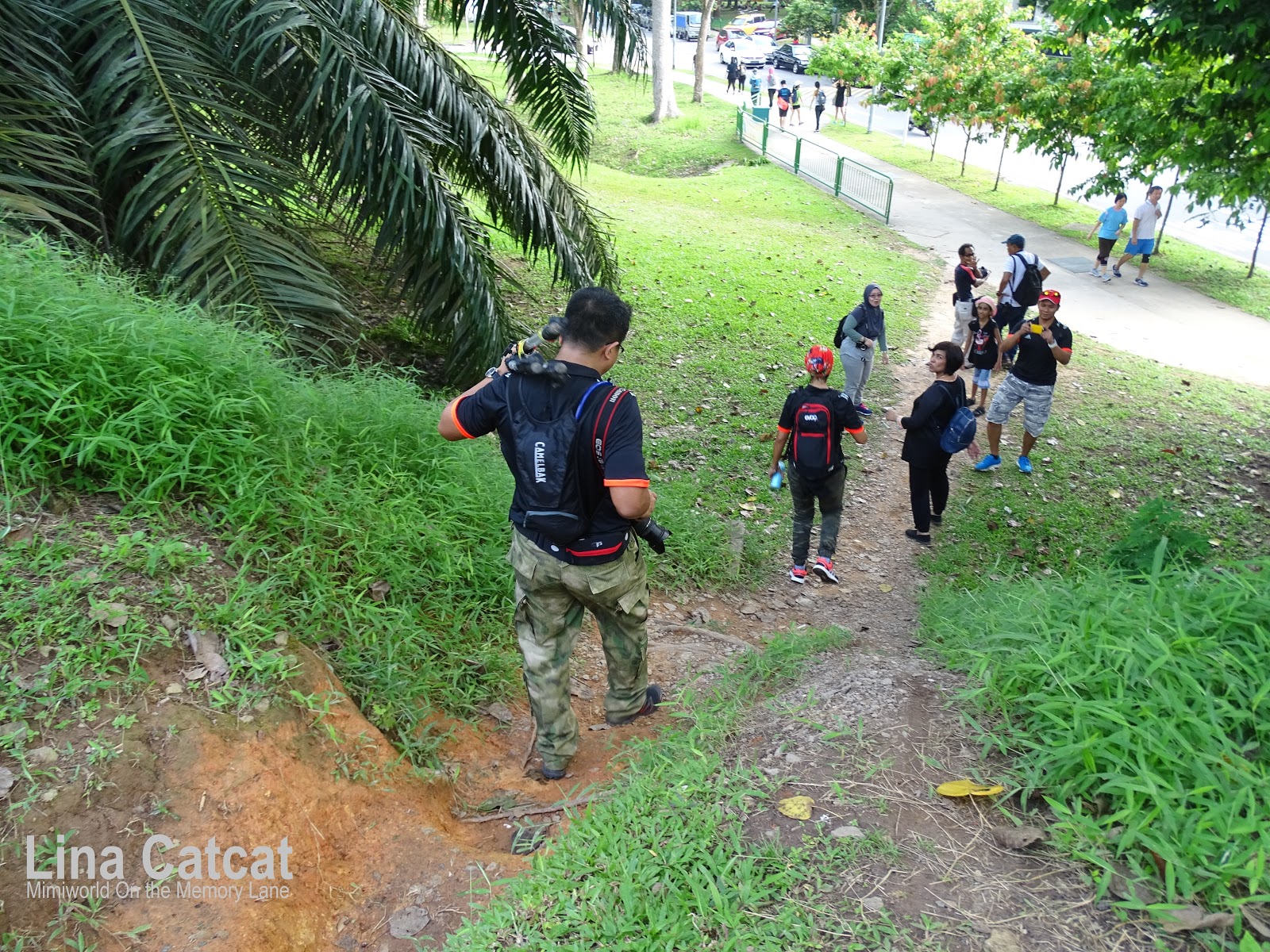
Massive crowds walked in line
Meeting place was at Marsiling Mrt at 8.00am and it was delay till an hour or so because of the huge crowded gathered outside mrt.

After an hour later, we proceeded on our journey to the former site of kampongs demolished long ago along the Sungei Mandai Besar and Sungei Mandai Kechil, where large mature mangroves exist alongside the structures of the former kampongs (demolished) - Kampong Mandai Kechil and Kampong Lorong Fatimah.
Site of Kampongs@Sungei Mandai Kechil (Small Mandai river)

Former sites of Kampongs where it was once stood
Mandai mangrove is located between two rivers Sungei Mandai Besar (Big Mandai River) and Sungei Mandai Kechil (Small Mandai River) hence the mangrove was autonomously named Mandai. This 10-ha mangrove area once housed several Malay villages. One of the kampongs that was documented fairly well was Kampong Lorong Fatimah (Village of Fatimah’s Alley). Below is a typical of kampong looks like this in the past.

Typical Malay kampong
Credit: NAS
The characteristic of a typical kampung house is its on stilts or piles. This was to avoid wild animals and floods, to deter thieves, and for added ventilation.
There was once kampongs located along Woodlands road - Kg. Mandai Kechil and further up near the Causeway to where Woodlands Police Station and Customs Station was once stood close to Kg. Lor Fatimah.

There was once kampongs located along Woodlands road - Kg. Mandai Kechil and further up near the Causeway to where Woodlands Police Station and Customs Station was once stood close to Kg. Lor Fatimah.

Kampong Lorong Fatimah
Kampong Lorong Fatimah was once situated off Woodlands Road, near the causeway, past the immigration checkpoint. Kampong Lorong Fatimah was struggled to exist until 1989 when the land needed for the extension of Woodlands Checkpoint. Before the construction of Woodlands New Town in 1970s, this kampong seemingly isolated from the rest of Sg as it was sandwiched between the Johor Strait and forested land.
Some of the houses were constructed on stilts. Only a small channel separated this kampong from Johor. In the past, this kampong was filled with sampans or koleks ferrying people between Johor and Singapore. With the sea on one side and a jungle on the other (before Woodlands was fully developed), this kampong seemed very cut-off from the rest of urban Singapore. Entertainment in the past included Ronggeng (a Malay ethnic dance) with the nomadic boat people who came here with their gongs, drums, tambourines and violas. Shopping was done from Indian men who came on bicycles carrying bundles containing clothes, towels and sarongs. In the past, the villagers were fishermen and boatmen, ferrying passengers between Johor and Sg but the newer generation were started to move out to work in the Woodlands Industrial estate. When industries were set up around Woodlands, many of them found jobs in the factories, while the younger ones found work in hotels and banks in Orchard Road. Kampong Lorong Fatimah was then pulled down to make way for the construction of the Customs Department extension to the Woodlands Checkpoint. The kampong’s residents were relocated, mainly to the Marsiling and Woodlands HDB estates.”
Some of the houses were constructed on stilts. Only a small channel separated this kampong from Johor. In the past, this kampong was filled with sampans or koleks ferrying people between Johor and Singapore. With the sea on one side and a jungle on the other (before Woodlands was fully developed), this kampong seemed very cut-off from the rest of urban Singapore. Entertainment in the past included Ronggeng (a Malay ethnic dance) with the nomadic boat people who came here with their gongs, drums, tambourines and violas. Shopping was done from Indian men who came on bicycles carrying bundles containing clothes, towels and sarongs. In the past, the villagers were fishermen and boatmen, ferrying passengers between Johor and Sg but the newer generation were started to move out to work in the Woodlands Industrial estate. When industries were set up around Woodlands, many of them found jobs in the factories, while the younger ones found work in hotels and banks in Orchard Road. Kampong Lorong Fatimah was then pulled down to make way for the construction of the Customs Department extension to the Woodlands Checkpoint. The kampong’s residents were relocated, mainly to the Marsiling and Woodlands HDB estates.”

Remnants of concrete left by villagers
Over the years of long forgotten to the present day, the kampongs are no longer exists to this day and what I recalled there was some left structure of remnants of concrete, pavements and bamboo poles stood on the ground base of once kampongs stood.
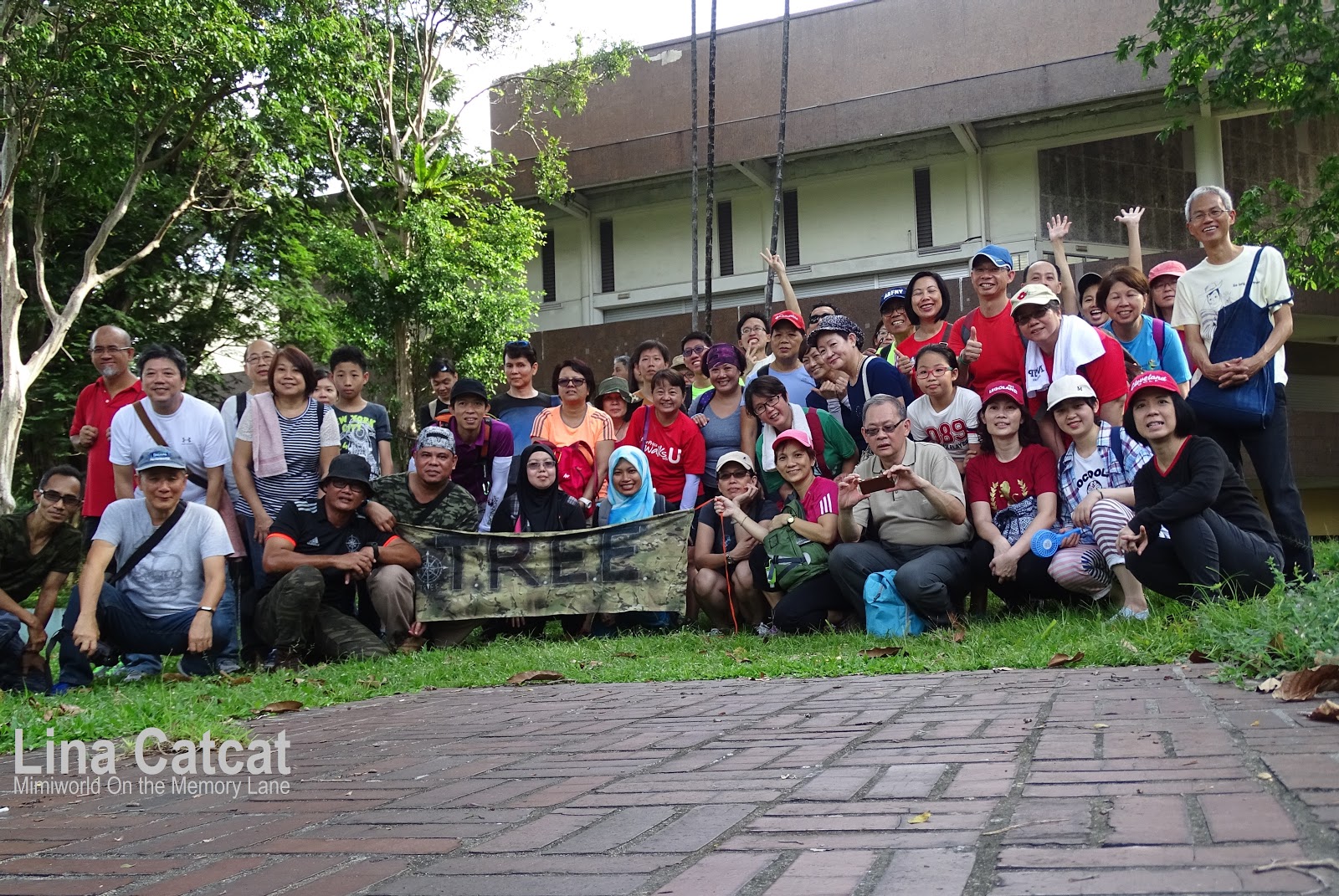
There was huge turnout of the TREE group of over 70 participants or even more. Thereafter, the TREE admin has decided to spit into two groups - Masta's group and Kamal's group to ensure that everything went smoothly otherwise it made participants confused to which side they should follow or it's hard for them (TREE) to gather large group into one. And of course, each group has a different side story of the Woodlands heritage trails. I do have a different story. Hahaha.
Below - A simple and effective group photo (Masta's group & Kamal's group) before we proceeded to other location trail.


 As we walked to the old Woodlands Town Centre was once the attraction of the both locals and Malaysians, was the first hub for transiting travellers. My ex-colleagues whom I knew and worked with, are from Malaysia, came to Sg to work and rented a room at woodlands estates and Yuan Ching (Taman Jurong) estates. They even called me up to meet at woodlands centre for a meal between 1980s-1990s. Sometimes I couldn't remember until I was brought to there. Reminiscing the place where I used to hang out and frequent coffee shop with my ex-colleagues and old friends. My ex-colleagues arrived at the Woodlands checkpoint to board a Malaysia bus after they booked a ticket (S$20-30) at checkpoint counter, to travel back to their hometown during CNY and Public Holidays.
The old Woodland Town Centre has come a long way in its heyday and a bright pastel paint on the wall seems struggle to hide mould and other signs of age on its worn facade on the both side of the staircase


 The pipelines would have been passed to the Singapore Government when British forces withdrew in 1971. Pre-war and post-war in this areas do not show a Pump House at the root of the Ruthenia jetty, and so it was probably built underground into the hillside - Marsiling tunnels. The former British RN fuel installation under Marsiling, unused for more than 4 decades and probably longer.


Masta's group at Blk 3A
Kamal's group at Blk 3A
As we walked towards the Woodland Town Centre after crossing the road, gathered around at blk 3A to hear the host's storytelling.

Old Shaw Brother (SB) Cinema in its heyday
The old (SB) Woodlands cinema used to be bustling in its heyday and now is old and abandoned with no more movies to release. There was an old favourite supermarket - the Oriental Emporium which sold everything and anything, locals and travellers needed.
Crowds gathered at the old cinema

Peek thru the old cinema theatre (2014)
The old Woodland Town Centre has come a long way in its heyday and a bright pastel paint on the wall seems struggle to hide mould and other signs of age on its worn facade on the both side of the staircase

Laundry cloths hanging to dry
A walk through the grand old dame Woodlands Town centre and old cinema that bring fond memories of my younger days when my old friends lived in this woodlands estates in 1980s. My family had been to woodlands town centre to look for the 'tailor-made' shops years ago.
Sadly, the 'fate' of Blk 1A to 6A Woodlands Centre Road were selected for the Selective En bloc Redevelopment Scheme (SERS) by the HDB. The affected 197 rental shops, eating houses and offices at Blocks 1A to 6A, and the hawker centre at Block 4A comprising 78 cooked food stalls managed by the National Environment Agency (NEA), will be cleared in tandem with the sold flats. Woodlands estates were 37 year old and built in 1980, the residents had moved to the new flats at Woodlands Drive 70.

Sheng Siong at Blk 6A Woodlands in 2014
There is a Sheng Siong supermarket at Blk 6A was supposed to move out by end of Sept 2016 (last year) and I heard that the supermarket is given an extended till end of June 2017 this year. It therefore intends to renew its lease for its Woodlands Centre Supermarket till that date.

Old 'No Parking' signboard (2014)
I remember that the lonely old signboard stood out of its own in the middle of the carpark close to the old Woodlands cinema and I didn't see it today, could it be still there, I am wondering...

Woodlands Checkpoint & Customs (2014)
Strategically located next to the Woodlands Checkpoint and Customs, it was known for its many shops and businesses selling a variety of goods, textiles and accessories shops. Another highlight of the area was the competitive exchange rates offered by the money changers. A bus interchange is located nearby, also served a 'drop-off' point for mostly cars and Malaysian buses ferrying workers into Singapore. 
Spiral Ramp structure
We gathered at a spiral ramp structure next to overhead bridge at Blk 6A. This spiral ramp structure is for 'human' traffic (pedestrians) and NOT for bicycles and motorcycles.Back in the old days when the bicycle tracks and park connectors were non-existent at that time, the Woodlands Town Centre was a big draw for those who liked to walk or cycle. 
Spiral ramp structure links to overhead bridge
Most notable was an underpass linking the 'Lookout' Tower of the Woodlands Town Garden to the Old Woodlands Town Centre. This concrete structure had three underground levels, equipped with a basic staircase.

I recalled that the staircase at old woodlands checkpoint had no escalators at that time, my relatives as well as my family had to drag our luggage up and down the staircase and walked over the other bus station after first checkpoint was passed, to board Malaysia buses to KL after our passport had stamped (well it was in old fashioned way to be stamped). But we were lucky as we have elderly families among us and we queued to the special counter to clear without any problems.

At one time, Singapore purchased US fighter planes and attack helicopters. In the past, hiring a helicopter to Malaysia used to be very expensive and was only for the rich.
Recently last year in 2016, the news was announced that tickets for Shuttle Tebrau, the shuttle train between Woodlands and JB Sentral, will no longer be available online from Dec 1 onwards. Commuters also will not be able to book tickets in advance. The ticket sales will only be released at 8.30am one day before departure, and will only be available at KTM Intercity counters. Sales will be limited to four tickets per person. The tickets were previously available 30 days in advance online and at ticket counters. Accordingly to Malaysian rail operator Keretapi Tanah Melayu (KTM), which runs the service, explained that the change is to avoid the abuse of ticket sales and overcrowding trains. This is to ensure that all passengers have valid tickets to board the train. The Shuttle Tebrau was launched in July last year to ease traffic congestion along the Causeway.
Upcoming of the two MRT stations; Woodlands South and Woodlands North, both located on the TEL, are planned to be built in Woodlands town, bringing convenience to commuters. In addition, the current Woodlands station will become an interchange linking the North South Line and TEL (Thomson-East Coast Line). Travelling times are expected to be reduced.

Old Woodlands Checkpoint
I could remember...a long time ago, my family and I as well as relatives used to travel by coach booked from agencies (Five Stars, 707, Konsortium and others) and the pickup point located at Golden Mile Complex, to Malaysia and even Bangkok (took about 11-12 hrs) to reach the destination at HaiYat terminal thru old Woodlands checkpoint. I recalled that the staircase at old woodlands checkpoint had no escalators at that time, my relatives as well as my family had to drag our luggage up and down the staircase and walked over the other bus station after first checkpoint was passed, to board Malaysia buses to KL after our passport had stamped (well it was in old fashioned way to be stamped). But we were lucky as we have elderly families among us and we queued to the special counter to clear without any problems.

Woodlands Train Checkpoint (2014)
At one time, my family and I took a train at Woodlands Train Checkpoint to JB in 1970s to visit my mum's long-time friend in KL who was a minister by then. Instead he asked us to take a helicopter that would be faster.At one time, Singapore purchased US fighter planes and attack helicopters. In the past, hiring a helicopter to Malaysia used to be very expensive and was only for the rich.
Recently last year in 2016, the news was announced that tickets for Shuttle Tebrau, the shuttle train between Woodlands and JB Sentral, will no longer be available online from Dec 1 onwards. Commuters also will not be able to book tickets in advance. The ticket sales will only be released at 8.30am one day before departure, and will only be available at KTM Intercity counters. Sales will be limited to four tickets per person. The tickets were previously available 30 days in advance online and at ticket counters. Accordingly to Malaysian rail operator Keretapi Tanah Melayu (KTM), which runs the service, explained that the change is to avoid the abuse of ticket sales and overcrowding trains. This is to ensure that all passengers have valid tickets to board the train. The Shuttle Tebrau was launched in July last year to ease traffic congestion along the Causeway.
Upcoming of the two MRT stations; Woodlands South and Woodlands North, both located on the TEL, are planned to be built in Woodlands town, bringing convenience to commuters. In addition, the current Woodlands station will become an interchange linking the North South Line and TEL (Thomson-East Coast Line). Travelling times are expected to be reduced.

The Causeway (taken in 2014)
Photo by Lina Catcat (me)
Singapore-Johor Bahru Causeway is a 1056m long cross-country link over the Straits of Johor, connecting Singapore and Malaysia. First proposed by the Director of Public Works, Federated Malay States and built at a cost of $17 million, it was officially opened on 28 June 1924 by Governor Sir Laurence Guillemard, in the presence of His Royal Highness, the Sultan of Johor. Do you know....Sultan Ibrahim Iskandar of Johor, his great grandfather, the late Sultan Ibrahim, who opened the Causeway, designed for both road and rail links. He paved the way, literally, for the first train to rumble into Singapore from Malaysia back in 1923. Besides trains, he (Sultan of Johor) flies jets, helicopters, and he sails his own yacht too. As you can see the Johor Straits along Berjaya Waterfront (background far right) with other buildings such as AIA and residential buildings.
Short History of the Causeway
The earlier seige explosion of the Causeway on 31st Jan 1942 in the morning, the explosion could be heard on the south coast of Sg. The Causeway was a road built on a foundation of big boulders at the cost of over £4,000,000, unlike a bridge, it was hard to cause substantial damage. Blowing the Causeway was to stop the Japanese advance as many allied troops left behind in Johor, swam the Straits over the next 24 hours with ease. Search Lights has been set up along the shore but there were no concrete defences. The main supply of water from Johor also destroyed in the explosion but there were two reservoirs on the island so water was rationed by having one tap in use for 3 households, food was not a problem.
Rotherham Gate (background)
Rotherham Gate could be seen in the background, during workers strike in 1952.

Rotherham Gate (1960s)
Source: Deret Tait


There was an Ruthenia jetty (just after customs jetty) that was used to fuel RN ships prior to completion of the British Naval Base (1938) and was fed by a pipeline from the RN Oil Fuel Depot at Kranji (completely destroyed during the Japanese invasion). Other jetties were Customs jetty, Woodlands jetty (formerly Shell jetty) and the large 'L' shape was used by the Royal Malaysian Navy – the Tentera Laut Diraja Malaysia (TLDM).
The Rotherham Gate that was the last marked as the reminder of the Naval Base still stands, a mark structure is hidden by the roots of the tree covered tightly and only a partial of structure is seen.

Map of location of the Rotherham Gate
A gate post marked belonging to the former Rotherham Gate, the northernmost into the former base, is the last of the several entrance into the huge naval facility that was once been the pride of the British Empire. Rotherham Gate was built in 1945 in commemoration of the role of the Commander of RN Destroyer HMS Rotherham in the acceptance of the surrender of men from the Japanese Imperial Navy at the Naval Base in Sept 1945. It stood right until the end of Oct 1971 when British Forces withdrew from Sg.

The Gate hidden by roots of the tree

Structure Gate seen hovering by tree roots

Naval Base Road (then)
Courtesy of NAS

Admiratly Rd West (formerly Naval Base Rd) (now)
I remember the road that I used to walk pass in 1990s when my former company organised a 'farm' trip, at that time the road was called 'Naval Base road'. Years on, the road renamed to 'Admiratly Road West' as seen at the junction road (as seen in pic above). The 'stretched' in the naval base area was called Naval Base Road (now called Admiralty Road West), The naval base was renamed to Woodlands Garrison when ANZUK forces took over, before the handover to Singapore.
The word "Admiratly" is a suburban neighbourhood of Woodlands New Town, is connected to Sembawang and Yishun via Gambas Avenue; the Woodlands Industrial Park and Senoko Industrial Park via Woodlands Avenue 10 and stretch to the Causeway via Woodlands Ave 12. It also reflects the area's association with the large British Naval Base (in the Sembawang area) that was established between 1923 and 1941.
There was once the prison which is situated alongside the Admiralty West Park was originally the site of a Royal Air Force (RAF) radio station, and later became the base for the Royal Malayan Navy (RMN). The RMN’s origins are linked to the Straits Settlement Naval Volunteer Reserve (SSNVR), which was formed on 27 April 1934 by the British colonial government.

Off to the Marsiling tunnels
Thereafter we went to the Marsiling tunnels which is said to be hidden away from the forested jungle. Oh yes, I went with Sembawang group under Encik Kamal who organised a trip there 3 years ago after the news was announced in the media in 2014.
Encik Kamal's group bashed thru fallen branches
There are several tunnels on every part of the forested that leading us to the opening tunnel in the southern side.
West Entrance tunnel (2014)

East Entrance tunnel

North Entrance tunnel

Tunnel floor plan with four entrance
Two Marsiling tunnels had been sealed off are north entrance and east entrance. East and West entrance are connected directly to the Main Tunnel. The underground tunnel was built on an uneven hill slope.
This time I went with TREE group and a special host Encik Kamal who was a resident of naval base who could share his story. The Marsiling sites were once used as a fuel reserve facility for the Royal Air Force and not for the Royal Navy. Its storage facility underground (Woodlands North Depot) supplied fuel oil to the Royal Air Force, refuelling the ship oiler known as RFA Ruthenia berthed Ruthenia Jetty as the stationery oil depot.


After the Marsiling tunnel, they went to the 'unknown' location - the 'water' well nearby the forested area that close to the tunnels. I couldn't provide the location of the water well as this is their 'secret' place not to be known to the public otherwise it will be sealed up or barricade it.

Under the pipelines
Unfortunately, the fallen tree branches has blocked us to deter entry to the tunnels but they wouldn't give up easily, bashed thru the fallen branches or even walked under the pipelines to walk towards the thick forested up the hill to where the tunnels are.
Masta's Group waiting at the pipelines
Later Masta's group came in after Encik Kamal's group has passed through the forested jungle. 
One of admin TREE enters the fallen tree branch
Before that, one of the admin TREE walked thru the branches and checked everything was alright, then...

Admin TREE signal using his hand gesture
signal to the other admin TREE Faye who happened to pass by the pipelines to ensure everything was okay and ensure of their safety ahead. Seeing the picture above makes me think he was talking to a 'invisble' person (hidden in the bushes) in the air. Giggles.

Masta's group walked up the forested
After given the 'green' light from the admin TREE, they proceeded and walked up the footpath to the pipelines and to bash through the forested along the pipelines, up the hill to the Marsiling tunnels.
Overlooking Johor Strait taken in 2014 (Then)

Overlooking Johor Strait taken in 2017 (Now)
I made my way out to the main road where the group had walked this footpath, I could the see the scenery outside and I realised that the buildings at Johor Strait have sprung up over the years when I first stepped onto the footpath as above pictures.
Me at the south tunnel entrance in 2014
As for me, I have to skip this trail to these tunnels as I had an appointment and at least I am glad I had visited the tunnels before. Behind me is South tunnel entrance which has three level down while North tunnel entrance (sealed off) is a four level down.After the Marsiling tunnel, they went to the 'unknown' location - the 'water' well nearby the forested area that close to the tunnels. I couldn't provide the location of the water well as this is their 'secret' place not to be known to the public otherwise it will be sealed up or barricade it.

Spotted them (in red dot) afar in the thick forested
Before I leave, I managed to snap some photos (below) of the participants and TREE admins at the foot of the forested hill a distance away from me. Above pic is where I took a shot of them in the thick forest hill up above.
Spotted them from afar!

Give a helping hand

Faye, Helmie & Selfie queen Niza
Seeing them as happy as they are, at last they have accomplished their mission at the end of the last trail. At least, I am glad everything went well for the TREE and their group.