
Old Bukit Timah Railway station
Credit: Postcard
It's been a long time since I visited Bukit Timah ages ago and a few years ago and had blogged my journey to Bukit Timah railway in 2011 (6 years ago).
Me & My Younger bro in 1970s
A long time ago, some of my relatives lived kampong villages at Bukit Timah areas which were close to Jalan Kampong Chantek and Rifle Range road nearby Lorong Senapang for as long as I could remember. Picture below that some of my relatives lived similar to this house in early 1980s
Chinese hse@Jln Kampong Chantek
credit: nlb
There was a roadside stalls along Bukit Timah road stretch in the past where one of my oldest uncles's wife (my mum's oldest sister-in-law) used to have her roadside stall which she sold 'fishballs noodle' along the road in 1970s.
Swiss Cottage
Photo credit by Phase
The place was used to have a Swiss School (Swiss Cottage) where my former boss and his classmate (my eighth uncle - UK) had studied there located along Dunearn road in 1960s. There was a Swiss Club near to the school.There is a infamous shortcut across the railway from Jalan Anak Bukit to Rifle Range road where there occurred several fatal accidents involving pedestrians over the years. It was also said that a girl was run-down by a train near the shortcut sometimes in 1970s.

shortcut to Rafle Range rd
Credit: nlb
The 'shortcut' where my friends and I were using this route to Rifle Range Road to where the old Gun club was located. But somehow we (the TREE members) were there earlier. The road (Jalan Anak Bukit) is near to Bukit Timah Shopping centre where one of my uncles's old shop is located. A railway bridge at Rifle Range Road junction, at Dunearn Road. Rifle Range Road is named after the rifle range built by the Singapore Gun Club and also home to Chartered Industries and School of Ammunition. The Singapore Gun Club at Rifle Range Road (where we were in the longkang earlier) close by, was started in the early 1950s. It first operated from a tiny zinc-roofed wooden shed of about four square metres. Before the Japanese occupation of Singapore, British forces used the site at the present clubhouse as an ammunition depot. Over the years, World War II grenades, bombs and even pistols have been uncovered from within the shooting range.
Bukit Timah area was my playground where my relatives lived a great house (kampong), a great garden, wildlife and a dark history. A very long way to walk down along the main road - Dunearn road or to drive or walk along Binjai Park and passed through the homes of the wealthy, or take the other road - Jalan Kampong Chantek.

I heard that the authorities will seal off the area around the old Bukit Timah Station in the first quarter of this year, to lay a 22-km stretch of water pipes to feed the Central Business District.


Kampong Chantek House
credit by nlb
Jalan Kampong Chantek is just a name if I could remember back then, this street name - which old folks who lived for decades thus used to called - over a mile long much of it cutting through jungle. Hitchhiking and trekking were common back then. People didn't think twice to stop their car and offer a lift to some poor soul walking the long road. There is a sharp bend in the road before you get to a hill. At the very end of Jalan Kampong Chantek was a small Malay village - a kampong with about 200 people staying in attap houses. There used to have a temple near the viaduct on Jalan Kampong Chantek. It was reported to have commented on the pretty village thus giving it the name, Chantek, which is Malay for pretty. Surrounding the area, is a single storey house in Jalan Kampong Chantek, from near the corner of Binjai Park towards Murnane Reservoir.I heard that the authorities will seal off the area around the old Bukit Timah Station in the first quarter of this year, to lay a 22-km stretch of water pipes to feed the Central Business District.

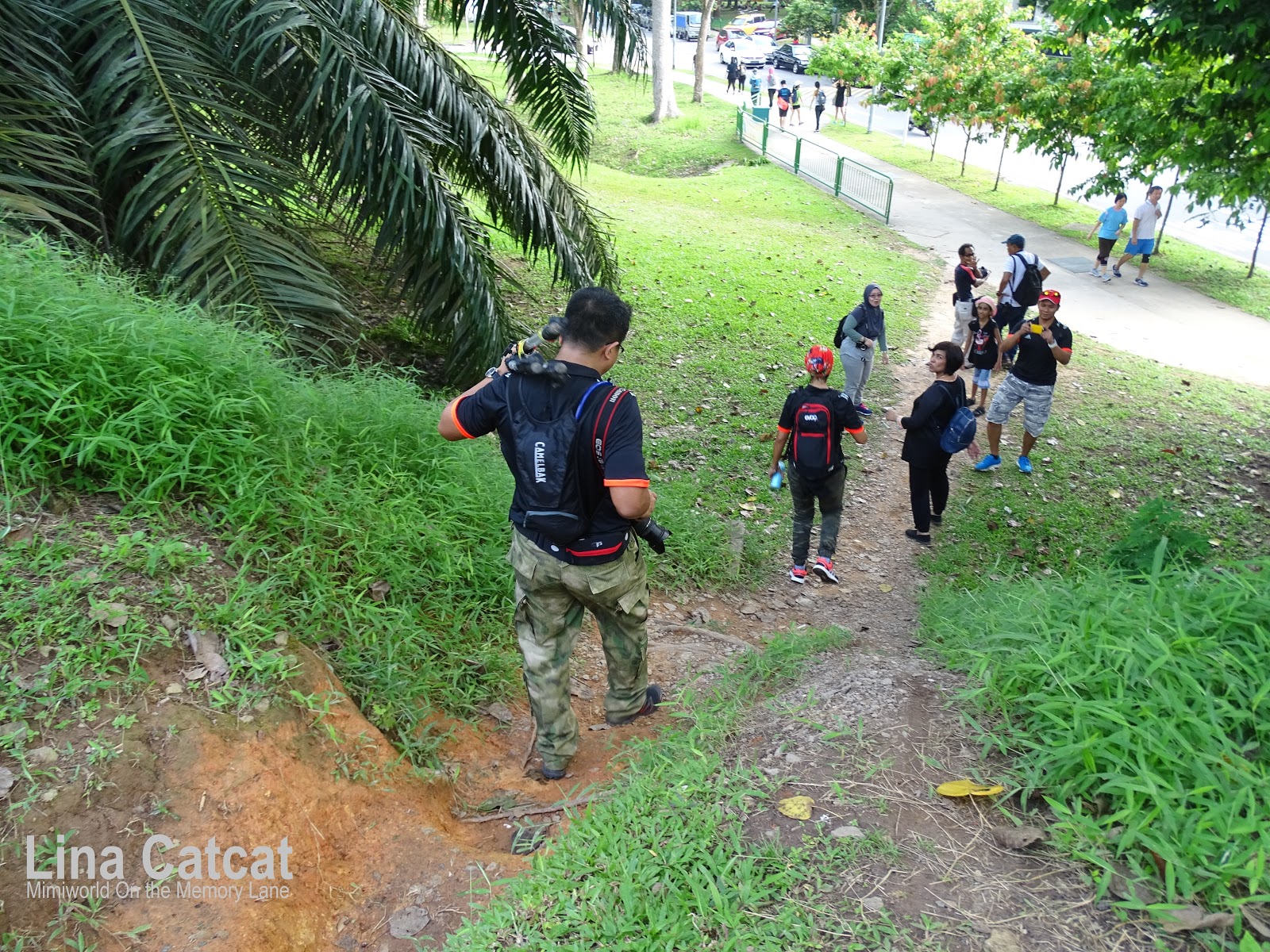
Tree Admin Faye taking attendance to members
On that day (12th Feb 2017), I was supposed to meet up with the TREE group at King Albert Mrt (Exit A) at 8.00am and I arrived earlier as usual as it was just 5 stops from my place. From then, we set out our journey at 8.30am to the old Bukit Timah station in 15-20 mins.
Rushing up the station's platform
Upon reaching the old Bukit Timah station, oh wow, everyone was rushing up the platform station as if they have not seen it before..giggles. Snapping away is very common among people as if they were at the station before. But I was not amused as I was there a long time ago.
Me@old Bukit Timah station in year 2011 (then)

Me@old Bukit Timah station (now)
My last journey or outing way back in 2011 (6 years ago), there was not much changing except I didn't see the sign box that station staff used to pass the 'horse-shoe' shape near the red-bricked signboard on the foot-track (below pic).
Signbox indicated 'horse-shoe' taken in 2011
One of the old stands for receiving the key token remained at Bukit Timah station in 2011 but now it was removed.
Tree admins talked about Bt. Timah hill
As you can see behind them is the sign box that indicated 'horse-shoe' shape ring on the hookstand had been removed! The 'signbox' hook is where the train driver dropped a key token for the northern section between Woodlands and Bukit Timah. So...where it has gone to...?
TREE Group@old Bt. Timah station (1st shot)

TREE Group@old Bt. Timah station (2nd shot)
2 Photos credit: Sarafian (Tuah)
After walked around at the station for half an hour till 9.30am before we proceeded our journey to the Bukit Timah Nature Reserve but before that we took group photos with members of TREE. Seeing them as happy as they are before the station closes.

former rail track path to steel rail-bridge
Now as we were arriving the Bukit Timah hill by walking along the footpath at Rifle Range road that I walked the same path in 2011.
4 digits number at the wall taken in 2011

Me stood at the concrete wall in 2011
I remember there is a number on the concrete wall back then and this time I didn't notice when I walked pass hastily but wonder whether it is still there or not, and because I have to catch up with them along the way. Would be glad if someone taken a shot while at the steel rail-bridge then you are lucky.

After passing the rail-bridge

Keep on walking the same path
As we keep on walking on the footpath that used to be the rail-track that I walked back then.

Overhead bridge wall taken in 2011

The Graffitied wall
Along the pathway, I carried on walking until I passed by the overhead bridge. But before that, the overhead bridge wall was not graffitied yet and then I saw it thus indicated that it would be sad to see this word 'Goodbye' or rather 'Sadbye' in short. On the other side of the wall are covered with graffiti. Overcome emotion by someone who was there, he or she walks pass daily.

At the slope of the hill
Along the pathway at Rifle Range road, we reached at the Bukit Timah hill along the rail-track and we have to crossing over the hill down slope. There we went down the slope one by one....then

Crossing over the hill down the slope
at last, the person from admin TREE is the last who crossed over the hill slope..

'Brave' Faye crossing over the hill slope
Feeling relieved as everyone is fine and yet they are determined to overcome the long journey which started from King Albert Mrt to the Bukit Timah hill but there is not the end of it as we continued the hardest path - Bukit Timah Summit, not all people can make it unless they have a strong will and go for it despite the age for as long as they are healthy and fit. But for me to be honest, I am not that healthy leh...but I am willing to go for it as long as it fit me in.

Bukit Timah Nature Reserve in 2011 (then)

Bt. Timah Nature Reserve (Now)
Upon reaching at the Bukit Timah Nature Reserve, I noticed there is much changes at the visitor centre (upgraded) after it closed for two years since 14 Sept 2014 to enhance visitor's safety. And it reopened in Oct last year following the completion of restoration works and sensitive enhancements that spanned two years. The two-year closure allowed NParks to repair and enhance the slopes and trails for public safety, restore the forest habitat. Some paths are not ready yet.

Taking a short break
While we are taking a short break for 5-10 mins before we moved on our journey to the summit.

Happy faces
Seeing the TREE members heading past the Visitor Centre to start the ascent up the Main Road leading to the Summit.

Steep slope
Up the steep slope is not an easy as regular joggers and visitors are spotted braving the steep slope of Bukit Timah hill as it will help them to burn calories in their body.
One foreigner and his child on his back
Spotted one foreigner carrying his child on his back with the baby backpack carrier (for hiking) braving the steep slope to the summit! He saw me and smiled after I snapped a shot of him!


Steep Slope beside the Kruing hut
It was indeed hot weather in Sg but a little cool breeze blowing on our faces while walking up the slope.


After half an hour, we finally reached the steps to the summit and yet another 15-20 mins to reach the summit but we caught our breath and a short rest at the 'Kruing' hut for 3 mins earlier. The next leg of the trek is the easiest as the flattest part of the summit

A short rest at Kruing hut
A tiring long pathway for them as if we run 6-7 km on top of the hill on the steep slope, I remember one elderly man who is the father of my friend aka member of TREE friends who managed to walk up the summit and also among the 'elder' members too.

Small & large steps leading to the summit
Walking up the steps to Bukit Timah Summit (Height [Ht] 163.63m). The stairs comprise of small and large steps juxtaposed side-by-side. It will take more than half an hour (30mins) to reach the summit. Our legs are becoming more tiring upon walking up the steps if you can count the steps (small and large steps). So I walked up from small steps to large steps side by side because large steps are a little higher than small steps (small steps in middle of large steps).

Bukit Timah summit
It was indeed half an hour or less to reach the top of the summit. Finally here we are! And then...we again have a group photo of the TREE at the summit.

TREE@Bt. Timah Summit
Photo credit: Sarafian Salleh
At the summit, members of the TREE snapping away surrounding of the hill and the rock. There was a history way back in the past, in the 1890s, a government bungalow or holiday chalet was once stood at the hill and was available for rent to the tourists ($2 a day, without bed linen!), they slept on the wooden floor. The surrounding area was designated a forest reserve in 1883, making it one of the first forest reserves in Singapore.Photo credit: Sarafian Salleh

Walked back to the visitor centre

One of the Admin TREE - Harry
Later we walked down the slope and back to the visitor centre where we met up with two admin TREE who were waiting for us. Mr Harry, an admin TREE gave talks about the caves located at the hill. The 'hidden' caves.. there is a boardwalk that would led us to the caves that hidden away from the city.
Some of the members would stay behind to continue the journey to the caves that they wanted to see! Some have other appointments or run out of their camera memory clips or likewise. Yes, I heard about these caves a long time ago and the last outing with my friends was in 2010. It has a dark history and not many people know.


The Boardwalks to the caves
There are also raised boardwalks that make the visitor experience more pleasant while protecting the natural environment. The boardwalks are made of wooden and hand-carried by workers and the repair works were done without machinery, I presume.
Surrounded by rainforests
In the forest, we are surrounded by the sounds of the rainforest and you may even get to spot the occasional wildlife.
Tomb marked in red taken in 2014
credit by Kwokyp
But before that, I remember there is a tomb marked in red at the Bukit Timah hill along the cave path and was wondering whether it is still there or not. The tomb is very old and has been there for a long time. What do you think? A tomb or another cave (3rd cave)?


Further up the caves, there is a stream before the end of Catchment path.


Curious onlookers to the cave
The footpath can be accessed either from the South View Path or Catchment Hut. Make our way along the Cave Path and we managed to find the caves by following the TREE admin ahead of us. The cave path is a moderate difficultly trail and there are many earth-cut along up and down the steps. The caves are still standing today.
One of the 1st cave
These caves were made by Japanese soldiers during World War II to store the supplies or other purposes. There are two caves (actually there are three caves) each cave is about 50 meters apart. The cave entrances are gated with metal grills to prevent people from entering. What a waste! But at least, it is safe for them from entering otherwise there is a creature hiding inside who knows.
The cave inside (1st cave)
Inside the darkest of the cave as the total and utter absence of light. Who could enter the cave without getting fear of darkest! These two caves run very deep, man-built, about two meters wide and two meters tall. The bars were installed to protect the bats that live in the caves from being disturbed by tourists or visitors. I presume

2nd Cave
We continued to the next cave within a short distance (50 meters) from it. It looks gloomy dark cave that covered with rock hill in the forests away from the city. These caves had a dark history unfold or hearsay from older generations like my relatives who lived in kampong at Bukit Timah. These caves were dug by Japanese soldiers sometimes in 1944 during Japanese Occupations.

A long gloomy dark cave
Inside the 2nd cave is rather long gloomy dark than the 1st cave. The caves were used for storing supplies and ammunitions during the Japanese occupation by the Japanese army. It is rumoured that it was to be military secret (the treasures that were looted by Japanese soldiers) during Japanese Occupations. A Japanese WWII veteran, whose name was HIGASHIURA Yoshifumi, there were 3 caves that were dug by the Japanese soldiers in the forest of Singapore, believed to safe-keep Singapore’s artifacts and treasures or was to hide treasures and artifacts. Believe it or not. Well.. is there a 3rd cave? Further up the caves, there is a stream before the end of Catchment path.
Suddenly I recalled about the Bukit Timah quarry, in early 1970s, the quarry was still filled with water collected from the hill near where the 2nd caves are located, is a stream flows to the quarry, ideal for swimming. It was known to be popular public swimming place as some elders or older generations might still remember.

Walked up the boardwalks to visitor centre
After visiting the cave, we walked to the same path and back to the visitor centre again. It was a such a long route (up and down the boardwalk) and was about 3km (to and fro). Our legs were getting tired and feeling weak as if we would stop for a short rest there.

The path to the stream
The last journey is the stream or you can say - longkang which people like me often called it on those days. I used to walk this path before as there are a two streams ahead in the forests along Raffle range road.
Stream Paparazzi
As we reached the longkang or the stream in clear water flowing from the pipe stand. My relatives (lived in kampung) used this stream in longkang to wash laundry and even bring fresh water home to boil and to wash vegetables in the past. Not forgetting the kampong kids bathing at the longkang.

Washing laundry in the 'clear' stream (then)

The stand pipe at the stream (now)

Closeup - Clear water flowing from standpipe
The kampong kids used to bath in the clear stream using the bathtub that filled with clear water. I was there as a kid.

Kampong Trail to the other stream
As we continued to walk along the kampong trail (Hindhede Entrance) to where the other stream is located along Rafle Range Road.

Curious onlookers at the longkang
Finally, we reached the last route which would be the end of our trail that stopped at Rifle Range road where the Singapore Gun Club was once stood somewhere nearby, were demolished a few years ago.

The longkang
The clear water flows from the hill to where the 1st stream is located.

The hill where the clear water flows
At the top of the hill where the clear water flows.

Time to take a group photo
After a long journey and finally ended here at the point location to where members of TREE would heave a sign of relief after many trails from the other directions where we first started at the mrt since morning.

TREE Group at the stream
Credit by Nen Fatah
At last but not least, we took a group photo at the stream along Rafle Range Road.

Blue Dragonfly on a tree branch taken by me
And added to the special specie (an insect), a dragonfly perched on a tree branch near to the stream.
Thanks to the TREE teams for the wonderful trails!
Nice memorable photos Lina
ReplyDeleteBest Regards
Sarafian
I went over this website and I believe you have a lot of wonderful information, saved to my bookmarks Bukit Timah Nature Reserve
ReplyDelete